Urban design of Huantang River
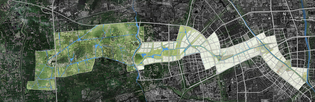
The Huantang river is a river system consisting of a variety of historic river sections under various names. Amongst them, are both artificial canals and natural water networks. The Huantang river extends in the northwest of Hangzhou, connecting the Beijing-Hangzhou Grand Canal in the main urban area and the Tiaoxi River in the western suburbs of the city.
As the city continuously expands west-wards, this scheme is designed to restore the important role of rivers in the city by utilizing the existing rich water network in the western region. It investigates the geological and ecological characteristics of the water networks along with its cultural and historical significance to put forward a comprehensive strategy as a regulatory guidance for the sustainable development of the city.
From the east to the west, the whole area along the Huantang River Basin exhibits the "urban area - suburban transitional area - rural area" appearance, which is an urban distribution typically seen in rapidly developing cities.
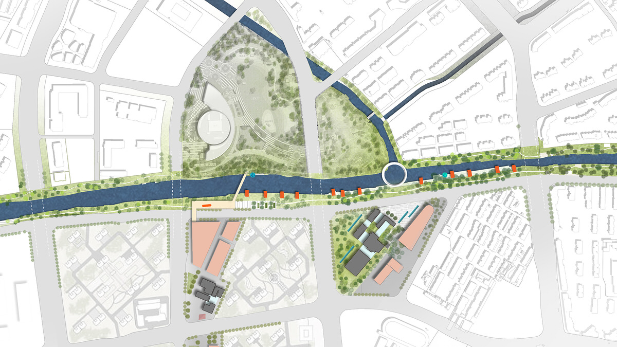
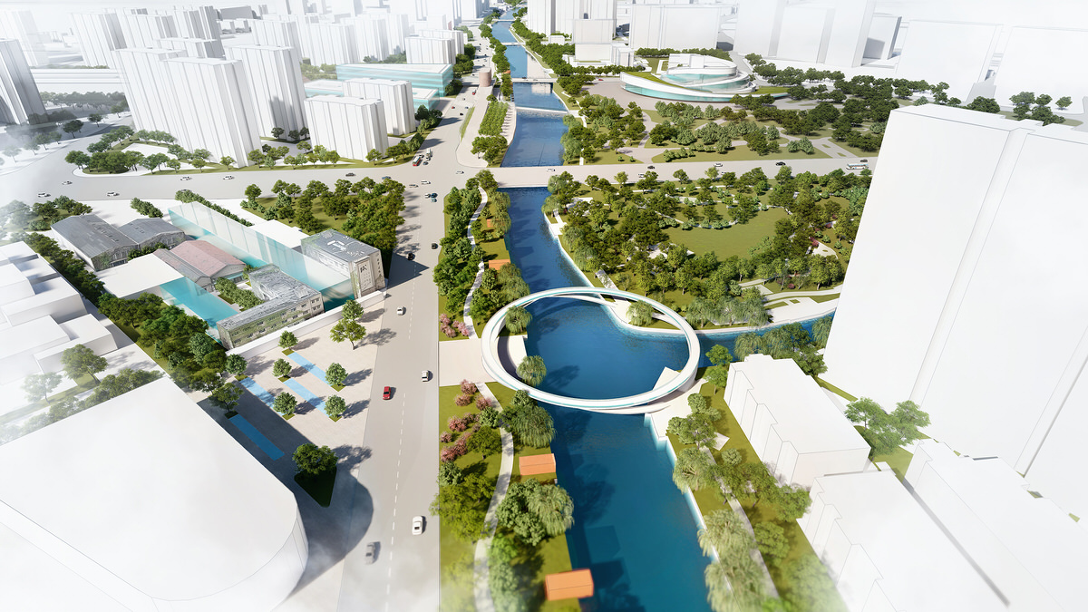
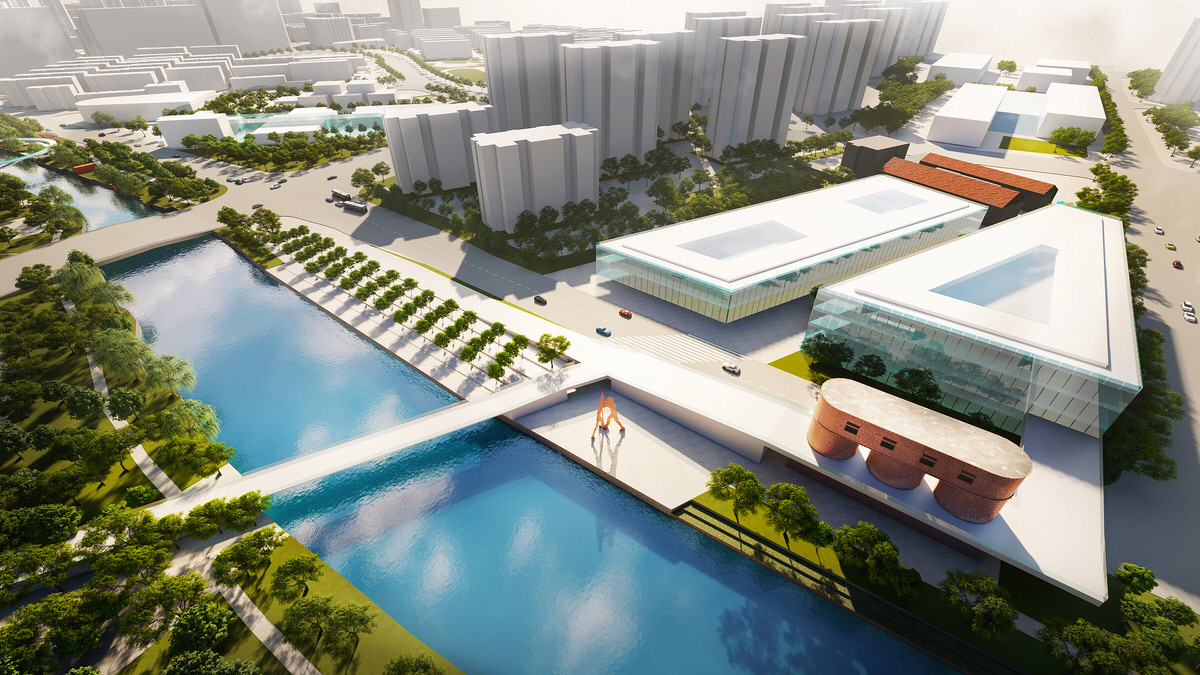
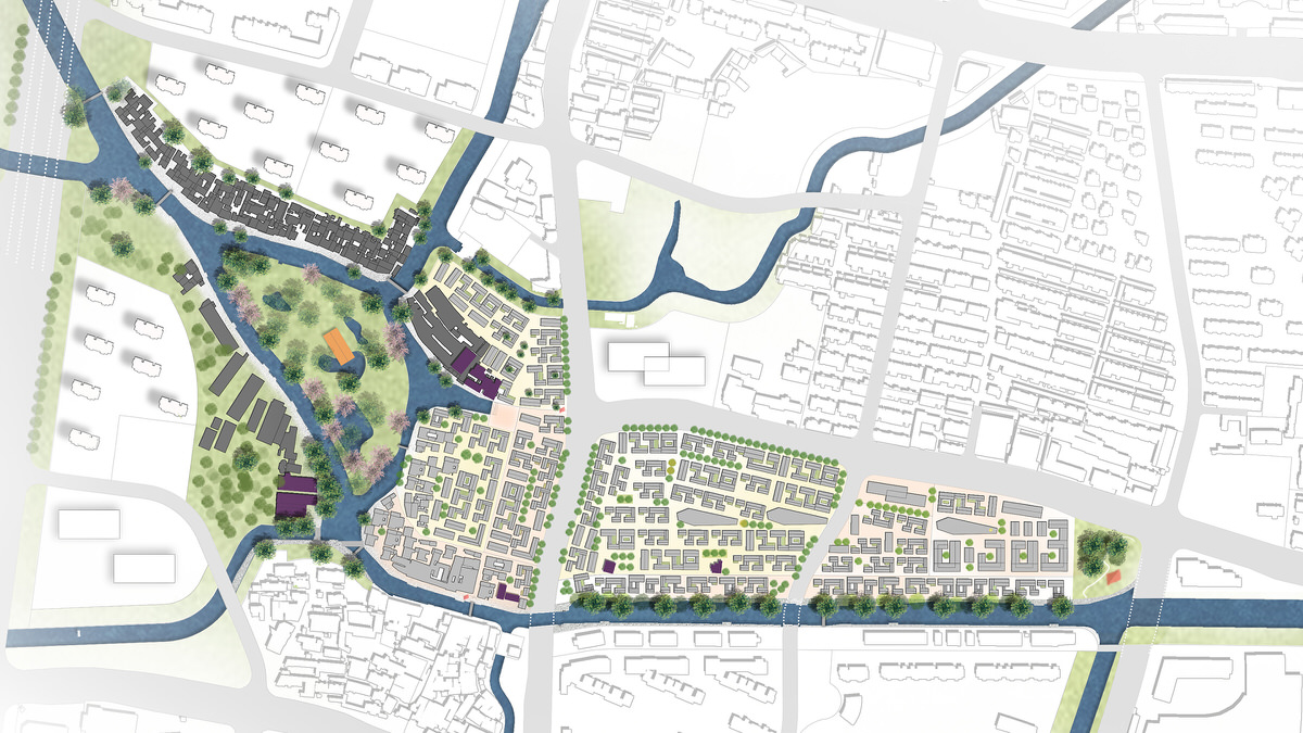
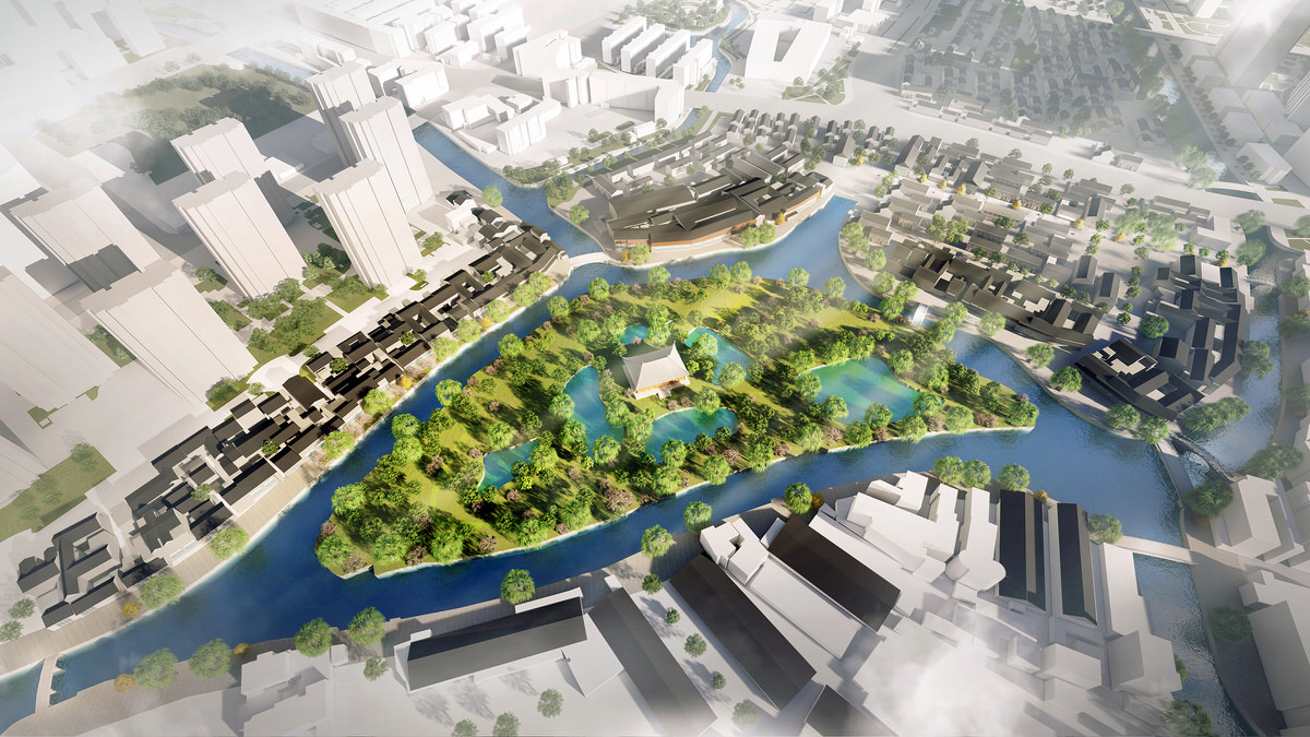
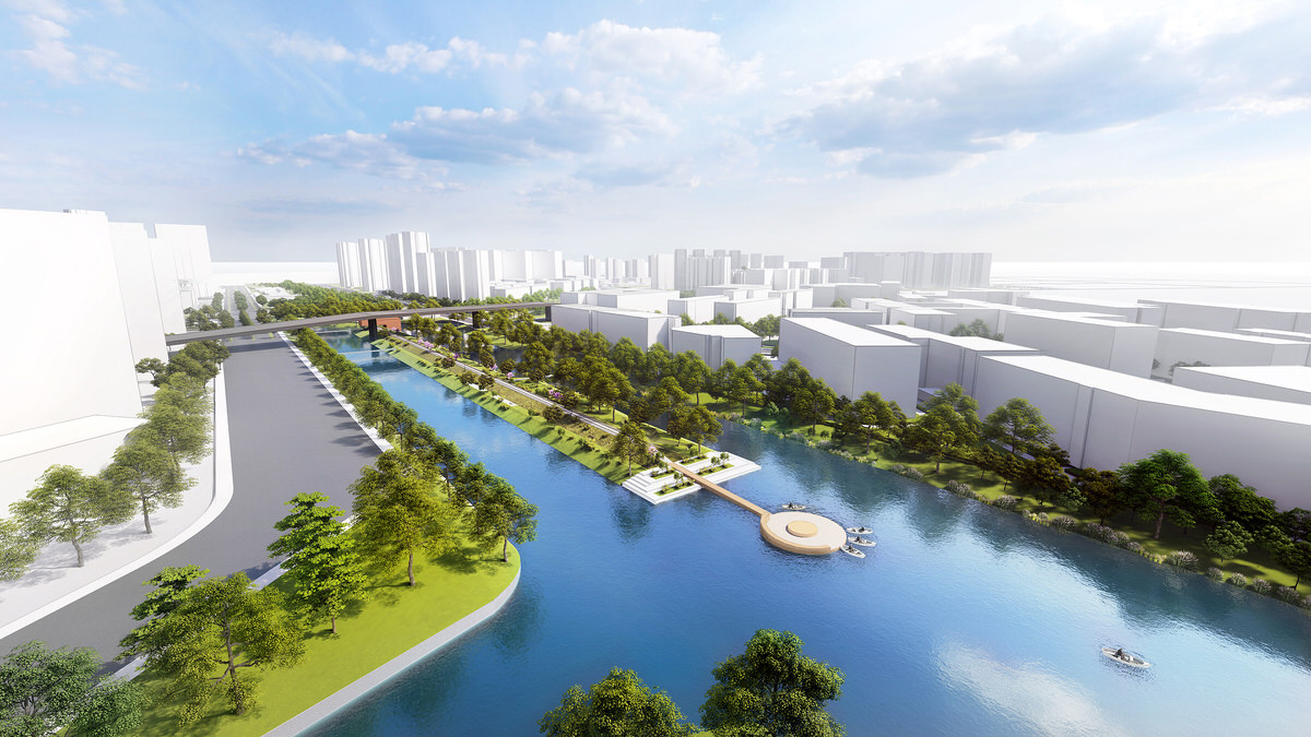
The scheme that addresses the urban area of the river aims at improving the vitality of both the water and its banks; focusing on the excavation of the industrial age historical relics near the Beijing-Hangzhou Grand Canal section; and restoring the overall structure of the historical waterfront in the San Dun Area. (Literal translation: the three peninsula. San Dun is a historical riverside town on the western boundary of the city.)
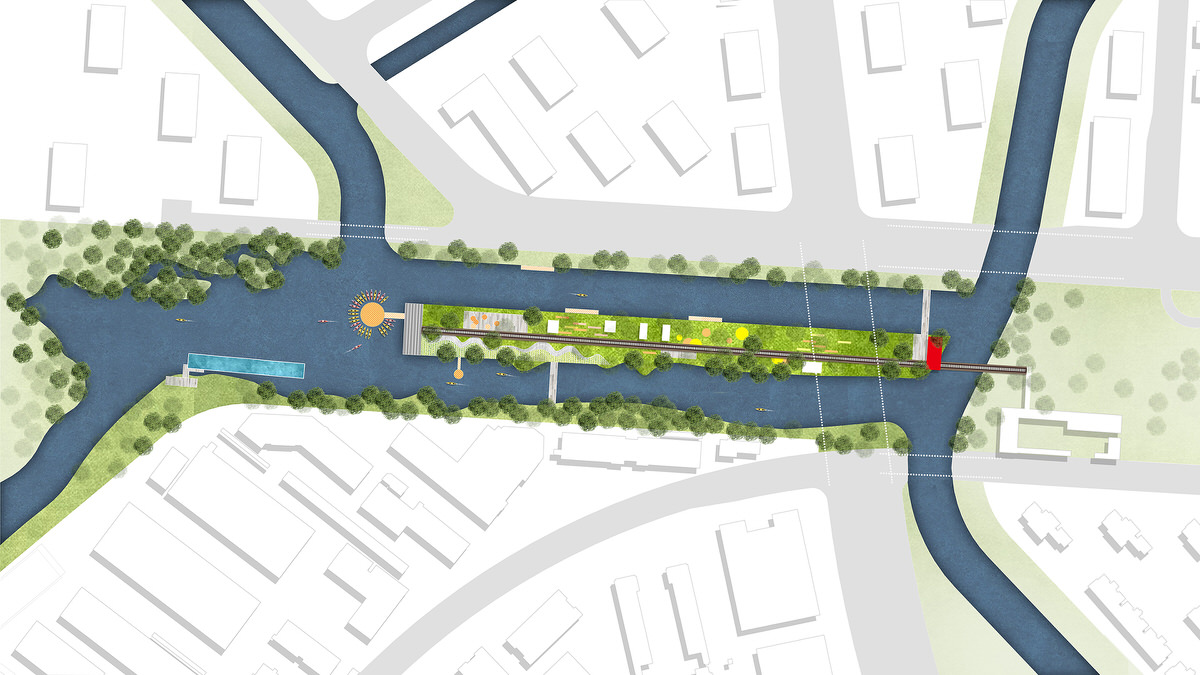
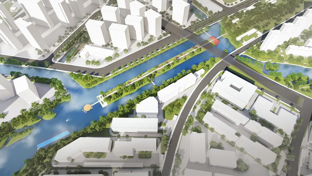
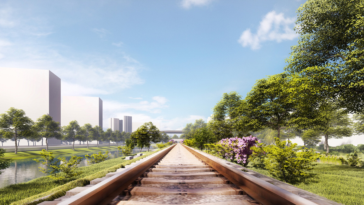
The design of the transitional suburban area of the river is mainly aimed at connecting the existing water systems, and creating an active waterfront public space. It achieves that by expanding the original watercourse and repurpose an abandoned freight railway track, currently segregating the areas, turning it into a railway heritage park.
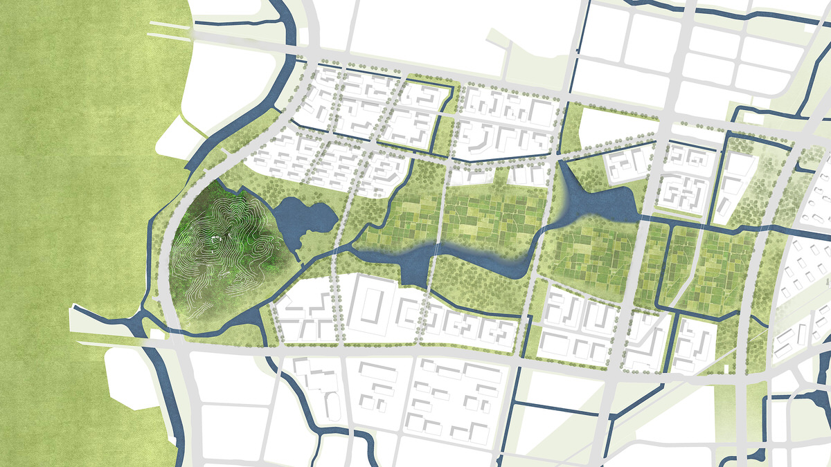
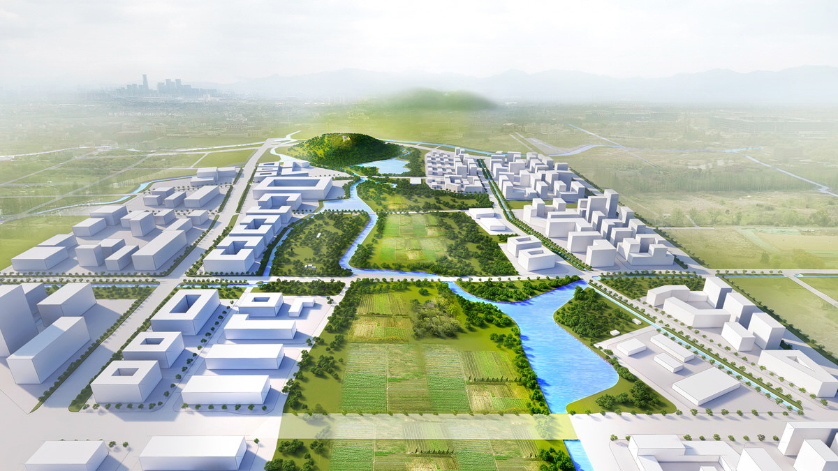
The design of the rural area of the river looks at its natural geographical pattern, it focuses on the distribution of the mountains, watercourses, farmlands and villages, and emphasizes on the interdependence of each element and the coherence of the regional ecology.
The above design has gone through three main stages, namely, primary data investigation; urban design and research; regulatory guideline formulation.
